Satellite Analysis
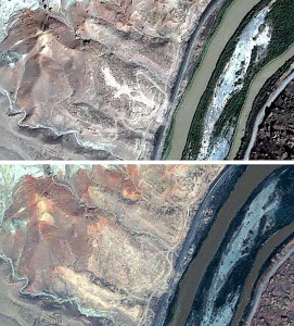
A December 2010 satellite comparison and analysis confirms that the Djulfa cemetery has been reduced to dust in Azerbaijan. The images below are from an American Association for the Advancement of Science (AAAS) study called High-Resolution Satellite Imagery and the Destruction of Cultural Artifacts in Nakhchivan, Azerbaijan. The images below have been sharpened by the Djulfa Virtual Memorial and Museum for clarity.
(click on image to enlarge)
In September of 2003 (upper data), the central area of the Djulfa graveyard appears to have sustained significant damage, but the areas to the northeast and southwest remain largely intact. By May of 2009 (lower data), however, the entire area has been graded flat, apparently by earthmoving equipment.
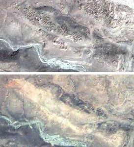
A close-up of the southwestern portion of the cemetery clearly shows the extent to which the area has been scoured. Upper data from 2003; lower data from 2009.
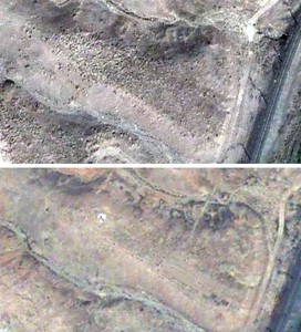
The northwestern area of the Djulfa cemetery in Azerbaijan has also been completely demolished. Upper data from 2003; lower data from 2009.
The analysis was conducted by senior staff at the AAAS Scientific Responsibility, Human Rights and Law Program in collaboration with Amnesty International expert and Djulfa.com founder Simon Maghakyan.


